![]()
- HOME
- SERENGETI-MARA ECOSYSTEM
- WHY COUNT WILDLIFE?
- 1999 MARA COUNT
- 2002 MARA COUNT
- 2002 SUPPORTERS LIST
- 2002 SUPPORTING COMPANIES AND ORGANISATIONS
- WILDLIFE COUNTING METHOD
- DATA COLLECTED
- MASAI MARA MAPS
- ANALYSIS RESULTS
- GALLERY
- DOWNLOAD CENTRE
- DONATE HERE
- CONTACTS
- FURTHER REFERENCES
How do we count?
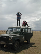
When we were not sure of the precise location of an animal or group of animals, we drove to the spot it occupied to obtain a definitive GPS reading. With practice, we allocated animals accurately within sub-blocks when they were located within 0.5 km of our sampling teams on flat, featureless ground or within 1 to 1.5 km where we clearly saw gallery forests, roads, hilltops or other features on our paper and digital topographic maps. From the maps of animal locations, we are developing detectability corrections for each species based on the size of each animal group and the distance from the observers to the animal group.
|
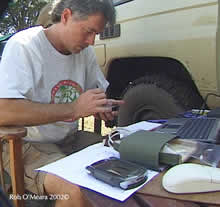
 We
count animals at a spatial resolution of 333 x 333m. Using global
positioning systems (GPS), our sampling teams navigate vehicles
down the centres of each 1- x 1-km block of territory while allocating
all animals observed into one of the nine nearest 333 x 333 m sub-blocks.
We
count animals at a spatial resolution of 333 x 333m. Using global
positioning systems (GPS), our sampling teams navigate vehicles
down the centres of each 1- x 1-km block of territory while allocating
all animals observed into one of the nine nearest 333 x 333 m sub-blocks.